create account login

|
Welcome to budget-travels-tips.com create account login |
|
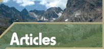
The Great Smoky Mountains National Park -- where fire and water meetby David JonesRead More Trip Reports ArticlesWe're going to the mountains, my folks said one morning when I was maybe eight years old. It may have been Easter or Memorial Day weekend, I don't remember. But it was my first significant trip out of the Delta flatlands around Memphis. Once past Nashville on I-40, I got my first experience with relief; rolling hills with the promise of bigger things just a couple more hours over the horizon. That night, we got into Gatlinburg, a small resort town on the edge of the Great Smoky Mountains National Park (GSMNP), so it wasn't until the next morning that I caught my first sight of the mountains. Stepping out onto the balcony of our hotel room, I saw the mountains in their morning glory, brooding and hazy from a rain the night before. On our daily drives through the park on the Little River Road, I also remember seeing the hikers coming out of the woods with their bright blue and red Jansports and Keltys. My dad, a sometimes-backpacker himself, told me about the men and women who hauled kitchen, bedroom and bathroom into the mountains with them to spend days wandering the trails, climbing mountains we couldn't drive to, taking in views we couldn't know about. For the drive back to Memphis, they bought me a copy of Harvey Manning's Backpacking: One Step at a Time, and from that point I knew my real home didn't have a roof. I lost my rookie backpacking stripes in the Smokies, at the tragically old age of twenty-seven. It was just an overnighter, sustained by a pack full of shiny new equipment. Disgustingly out of shape and woefully optimistic, it was all I could do to make the five miles to Walnut Bottoms backcountry campsite. It couldn't have been later than five o'clock when I made camp, but after eating one of the dozen or so bagels I had packed, I creaked and moaned into my sleeping bag and started my backcountry career. The oval-shaped GSMNP covers over a half-million acres on the Tennessee/ North Carolina border. Gently rolling mountains, crashing creeks, tumbling waterfalls, flora reminiscent of a Tarzan movie -- they're the vital organs of the Park, and can be found at almost any point within its confines. Treeline doesn't exist here, though geologists tell us it did at one time. Water, for millions of years falling through and falling on the mountains, has worn the once-mighty peaks down below the upper limits of vegetation. The western half of the park hosts the constantly-crowded Cades Cove exhibit, Elkmont and Tremont campgrounds, and Sugarlands Visitors Center. Access to Clingman's Dome, the highest peak in the park at 6,642 feet ASL, is also from this half. To many, the eastern side of the park offers inroads to the better backcountry. Access from the east, though not difficult, is more remote. Fewer attractions exist there for the motorhome-inclined, and from Appalachian hamlets like Cosby and Mount Sterling, Dollywood is just a bad dream. Regardless of where you start your hike, you'll be better off if you keep a few points in mind during the trip planning process. The Appalachian Trail, the grandfather of all long-distance treks, bisects the park and roughly follows the Tennessee/Carolina state line. Plan a trip involving an overnight stay in one of the AT shelters, and you better plan on spending the night with a dozen friends you haven't yet met. If the social scene bothers you, well . . . hike somewhere else; GSMNP is within a day's drive of nearly half the population of the United States. Enough said. For those who may be accustomed to the Rocky Mountain ways, remember this is a national park; backcountry camping is limited to established sites and shelters, each holding maximum occupancy loads and requiring advance reservations; I suggest way in advance, especially for holiday and peak periods. If a picture of some Woodstock-reminiscent scene is coming into your head, with tents and bonfires and guitar players spread out from horizon to horizon, ignore it. You will see other hikers, you may sleep closer than you want to another tent, but this is the Smokies; you don't come here to laze around camp for days on end. There's lots to see, and the only way you can see it is to walk. Expansive views are nice when they happen, but this country is thickly forested and unwilling to be trod upon off-trail. Microviews are the rule here; keep walking and you'll be repaid handsomely. GSMNP sports a high concentration of black bears; failure to bag and hang your food is inviting Ursa to your camp. Several campsites such as Walnut Bottoms have communal bearproof containers -- use them. A taste for human food is a death warrant for bears and deer alike. Water is the blood of this park, and there is usually plenty of it, either running through the hundreds of miles of creeks or falling from the eternally hazy sky. Common sense rules apply -- boil, treat or filter all water. Though many backcountry purists advise against publishing the whereabouts of a favorite place, there is a 3- or 4-day loop trip that encompasses everything I love about the Smokies -- babbling brooks, Tolkien-like forests, intoxicating smells and well-earned views. I won't give a step-by-step account, so you'll just have to trust me. From I-40 in North Carolina, take the Waterville exit and follow the signs to the Baxter Creek trailhead. Take Baxter Creek trail to the top of Mount Sterling, and reward yourself with a view from the top of the abandoned firetower there (start this hike early in the day -- it's 6 steep miles from the trailhead to the first campground). An easy 5.5 mile walk the next day will take you over the Mount Sterling Ridge trail to the shelter at Laurel Gap, and will leave you rested for a long hike out. Get up early the next day and take your time going down the Gunter Fork trail to the Big Creek trail, and back to your waiting car. This last leg is about 12 miles, but it's all downhill. If you have the time and inclination, there is a campsite about halfway down where Gunter Fork trail meets Big Creek. Send me an e-mail when you get back. For further reading, there is an excellent guidebook, The Best of the Great Smoky Mountains National Park, published by Mountain Laurel Place, Norris, Tenn. But the best guide is published by the Sierra Club; The Sierra Club Guide to the GSMNP, or something like that. I bought one, gave it to a friend who promptly moved it with him to Alaska, and have been looking for another copy ever since. It's a little blue book, and if you find a copy, please buy two; I'll gladly pay for yours if you can find me one, too. Trails Illustrated publishes the best map available, #229.
About the AuthorIf you're in Kansas City, Missouri on a sunny Sunday afternoon, stop by and have a beer on the porch with David and Donna Jones (ddjones@gvi.net), their dog Boo,
|
SearchReady to Buy Gear?Sponsored Links
Great Outdoor Sites |